
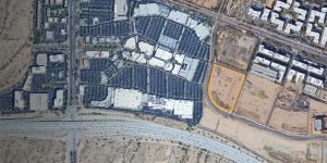
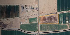
City North, Lot 12 – High Density For Sale Product Site
High Density For Sale Product Site Potential Buyers are required to sign a Confidentiality Agreement. See link below.
High Density For Sale Product Site Potential Buyers are required to sign a Confidentiality Agreement. See link below.

A 268.72-acre parcel in Maricopa County, Arizona, strategically located at the north and south of Interstate 10, east of the 531st Avenue alignment. This property is an ideal for long-term …
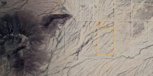
A 150.12-acre parcel in Western Maricopa County, Arizona, situated close to the Maricopa and La Paz County line. Zoned RU-43, his land is well-suited for investment opportunities or alternative energy …
A 270-acre parcel in Western Maricopa County, Arizona, located at the southeast corner of 539th Avenue and Elliot Road, near the Maricopa and La Paz County line. Zoned RU-43, this …
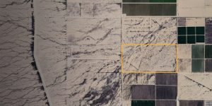
A 320-acre parcel in Western Maricopa County, Arizona, situated at the northeast corner of 539th Avenue and Southern Avenue, near the Maricopa and La Paz County border. Zoned RU-43, this …
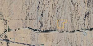
An 80-acre parcel in Western Maricopa County, Arizona, located east of the southeast corner of 411th Avenue and Northern venue. Zoned RU-43, this land is suitable for investment purposes and …
A 40.10-acre parcel in Western Maricopa County, Arizona, located southwest of 563rd Avenue and Indian School Road, near the Maricopa and La Paz County border. Zoned RU-190, this land is …
The Phoenix Elementary School District is looking to identify a developer to entitle and build a development opportunity that would serve the community.
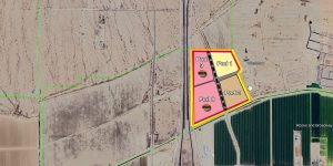
Westpark Pods 1, 2, 8 and 9 are located south of the southeast corner of Interstate 10 and SR 85 in the City of Buckeye (Maricopa County), Arizona. The property …
Located at the northeast corner of Perryville Road and Roeser Road in the City of Goodyear, Arizona.